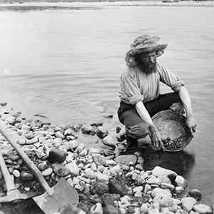
Near the Alaskan border with Canada, nestled along the Klondike River in Yukon, sits the Klondike region. On August 16, 1896, local miners discovered gold there. When news reached the United States and southern Canada the following year, it triggered a stampede of prospectors, forever changing the landscape of the Northwest and of North America. Eventually, one by one, miners sold out to large companies such as the Yukon Consolidated Gold Corporation, which amassed a huge collection of valuable geological data, including maps and technical drawings that are now in the LAC collection.
Our guests on today’s episode, Jeff Bond and Sydney Van Loon from the Yukon Geological Survey, discuss how mining was done in the Yukon Territory and how they are using the maps today.


